 Wilmington, NC is a mid-size city of just over 109,000 residents, situated in southeast North Carolina at the Cape Fear River. We've chosen Wilmington as the site of this week's scenic bike route review because the area is such a nice place to visit in the fall. It is still warm enough to enjoy a long ride but cool enough that you're not burning in the scorching sun.
The route we plan to discuss today is a 60-mile loop that begins and ends in the city. Along the way, you'll enjoy some stretches of fairly easy road and others with plenty of turns and twists. This loop makes a great ride for novices looking to improve their skills without having to be out in remote country. With that said, let's take a look at the details.
Riding the Route
We chose to start our ride where routes 76 and 74 meet, just northeast of Bradley Creek. There are plenty of places nearby where a group of bikers could congregate before heading out together. When you're ready to go, take Rt. 76 west across Bradley Creek and toward the Cape Fear Memorial Bridge. You will be traveling through the southern portion of the city at this point.
After you cross the bridge you'll turn north on Rt. 421/74 heading out of town. Watch for signs carefully, Rt. 74 splits off to the east while 421 continues north. Once outside of town Rt. 421 becomes a lazy country road. Stay on 421 past Two Pond Bay, then start looking for the signs for Blueberry Road (CR 1114) to your left. You'll be taking Blueberry Road up to the little town of Currie.
Some riders like to stop in Currie to see the Moore's Creek National Battlefield, the location of a significant battle of the Revolutionary War. Make a left on Rt. 210 if you're interested in seeing it; you'll find the entrance just up the road on the right. If you don't want to see Moore's Creek, turn right on Rt. 210 heading east.
Route 210 east will take you across 421 and down to 133 South. Rt. 133 south will take you to Rt. 132, then to Rt. 74 and right back to where you started.
Scenery and Road Conditions
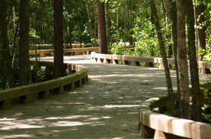
We can't say enough about the road conditions for this ride. They are excellent all the way, which is saying something if you've been on some of the back roads of the Carolinas before. As mentioned earlier, there are just enough challenges to help the novice improve his riding skills without being dangerous. And there's enough beautiful scenery to keep the veteran rider occupied all the way.
The first half of the ride takes you along the Cape Fear River to your right. There are some great spots to stop and take pictures or just enjoy the river. The stretch between Currie and Rt. 133 takes you through rolling farmlands, which, if you go during the fall, should be pretty active with harvesting.
Be sure to fill your gas tank before you leave Wilmington if you don't have enough fuel for the journey. There are gas stations along the way, but you'll pay more the further you get away from the city. As for stopping for a bite to eat, there are a number of options along the way. Many riders recommend a hot dog joint known as Paul's Place on Route 133.


